Orthomosaics, Point Clouds, and 3D Models: What Drone Data Users Need to Know
Drone aerial data has become a powerful tool for professionals who need accurate, current information about land, structures, and assets. But the raw images a drone captures are just the beginning. To turn those images into something measurable and useful, they must be processed into more structured forms: orthomosaics, point clouds, and 3D models. Each format serves a different purpose and suits different kinds of work. Understanding the differences helps you choose the right output for your project and get the most value from your drone data.
What Is an Orthomosaic?
An orthomosaic is a composite image made by stitching many overlapping drone photos together. The key difference from a simple photo collage is that each individual image is geometrically corrected. This correction removes distortion caused by the camera lens, the drone’s angle, and variations in terrain height. The result is a single, seamless image where every pixel is aligned to a real-world coordinate system.
Because of this correction, an orthomosaic acts like a map. You can measure distances, areas, and perimeters directly on the image with a high degree of accuracy. For example, a construction manager can measure the footprint of a foundation or the distance between utility poles without going to the site. The level of detail depends on the drone’s flying height and the camera’s resolution. Lower flights produce finer detail but require more images and longer processing time.
Orthomosaics are especially useful for applications such as site planning, crop health monitoring, and damage assessment. They give you a bird’s-eye view that is both visually clear and geometrically reliable. When you need a precise, up-to-date map of an area, an orthomosaic is often the most practical output.
Point Clouds: The Skeleton of 3D Data
A point cloud is a set of points in three-dimensional space. Each point has X, Y, and Z coordinates, and often carries additional information such as colour or intensity. Point clouds are generated from drone images using a technique called photogrammetry, or from LiDAR sensors that measure distances with laser pulses. Photogrammetry works by finding common points between overlapping images and calculating their 3D position, while LiDAR directly measures the distance to the ground and objects.
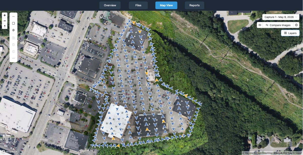
Point clouds are dense and rich. They capture the shape of the terrain, buildings, vegetation, and other features. The density of points can be extremely high, millions or even billions of points for a large site. This makes point clouds the raw material for creating other 3D products, like digital terrain models (DTMs) and 3D meshes.
Working with point clouds requires specialized software. You can view them, classify points into ground and non-ground categories, filter out noise, and extract measurements. For example, a civil engineer might use a point cloud to calculate cut and fill volumes for a road project. A forester might use it to measure tree heights and canopy density. The main trade-off is file size and processing power. Very dense point clouds can be slow to load and manipulate, but they provide the highest level of detail.
3D Models: From Points to Surfaces
A 3D model takes point cloud data and turns it into a continuous surface. This is done by connecting neighbouring points to form triangles or polygons, creating a mesh that represents the shape of the object or terrain. The result is a surface you can view from any angle, rotate, and even fly through virtually.
There are two common types of 3D models derived from drone data. A digital surface model (DSM) includes everything on the ground: buildings, trees, and other features. A digital terrain model (DTM) strips away above-ground objects to show the bare earth. For many engineering and construction projects, the DTM is more useful because it shows the true ground surface, free from vegetation and structures.
3D models can be exported in standard formats such as OBJ, PLY, or LAS, and imported into CAD, GIS, or simulation software. Architects use them to integrate existing site conditions into their designs. Mining companies use them to calculate stockpile volumes and plan extraction. The visual nature of a 3D model makes it easier for non-specialists to understand the spatial relationships on a site. However, the accuracy of the model depends heavily on the quality of the input data and the processing algorithms. Poor image overlap, low resolution, or unfavourable lighting can introduce errors.
How a Drone Mapping Platform Ties It All Together
Producing orthomosaics, point clouds, and 3D models from drone images is not a trivial task. It involves uploading images, running photogrammetry algorithms, adjusting parameters, and exporting the output in the right format. This is where a dedicated drone mapping platform becomes valuable. Such a platform automates much of the processing and provides tools for organizing, visualizing, comparing, measuring, and sharing the results.
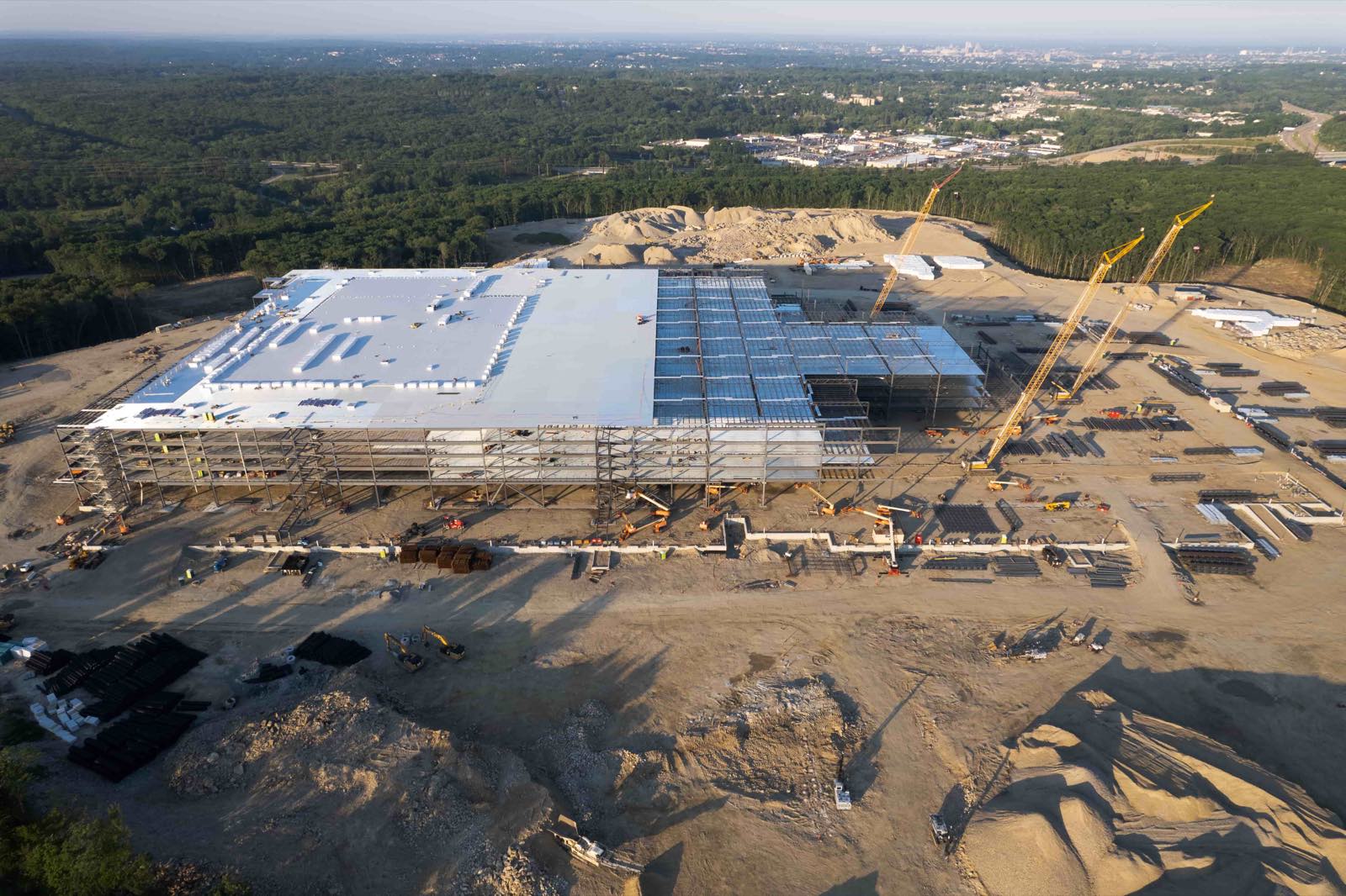
The National Drone Services drone mapping platform is one example of this kind of environment. It accepts uploaded drone data, processes it into the formats described above, and lets users view, annotate, and share the outputs. For a project manager who needs to deliver an orthomosaic to a client by the end of the week, having this workflow in a single web-based system saves time and reduces the chance of errors from moving files between different applications.
Choosing the Right Output for Your Work
Each format has strengths and weaknesses. Orthomosaics are best when you need a fast, map-like view for measurement and annotation. Point clouds are ideal when you need the highest level of detail for analysis, volume calculations, or generating other products. 3D models are the go-to format when you need a visual surface that can be imported into other design software or presented to stakeholders.
Consider the practical constraints. For a large area like a farm or a quarry, an orthomosaic is usually the first output to produce because it is quick to create and provides an immediate overview. If the project requires accurate terrain data, then a point cloud or DTM is necessary. If the goal is a visual fly-through for a planning application, a textured 3D mesh works well. The choice also depends on the software the recipient uses. Some clients only accept orthomosaics, while others expect a full 3D point cloud.
Processing time is another factor. Orthomosaics are generally the fastest to generate. Point clouds and 3D models require more computational resources and can take hours for large datasets. If you are working with tight deadlines, you might prioritize the orthomosaic and add the point cloud later if needed.
Practical Considerations for Working with Drone Data
Image Overlap
To generate any of these products, the drone must capture images with significant overlap. Front overlap (along the flight path) should be at least 70%, and side overlap (between adjacent flight lines) at least 60%. Less overlap can cause gaps or poor alignment in the final product. For complex terrain or tall structures, even higher overlap is advisable.
Ground Control Points
For projects that require high absolute accuracy, ground control points (GCPs) are essential. These are marked points on the ground with known coordinates, measured with a survey-grade GPS. The processing software uses GCPs to correct the model’s position and scale. Without GCPs, the model will be internally consistent but may be offset from the true location by several metres.
File Management
Point clouds and 3D models can be very large. A single project may produce gigabytes of data. A good drone mapping platform includes tools for viewing these files online without downloading them, and for sharing them with collaborators through a secure link. This avoids the need to email large attachments or rely on slow file transfers.
Bringing It All Together
Orthomosaics, point clouds, and 3D models each have their place in the drone data workflow. An orthomosaic gives you a fast, accurate map. A point cloud delivers dense 3D detail for analysis. A 3D model provides a visual surface for design and communication. Knowing which format to use and when depends on your project’s goals, your timeline, and the tools your team or clients use.
The National Drone Services drone mapping platform supports all three outputs within a single interface, making it easier to move between them as the project evolves. For anyone working with drone aerial data, understanding these formats is a step toward getting more value from every flight.
National Drone Services on social media
 Facebook